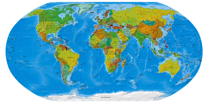
Карты Африки
Библиотека карт Перри-Кастанеда (более 250 000 карт онлайн)

Библиотека карт Перри-Кастанеда включает в себя более 250 000 карт онлайн.
Библиотека Университета Техас.
A, B, C, D, E, F, G, H, I, J, K, L, M, N, O, P, Q, R, S, T, U, V, W, X, Y, Z
- Africa (Political) 2012 (3.4MB) [pdf format]
- Africa (Political) 2011 (643K)
- Africa (Political) 2008 (942K)
- Africa (Political) 2007 (710K)
- Africa (Political) 2003 (302K) and pdf format (272K)
- Africa (Political) 2001 (232K) and pdf format (234K)
- Africa (Political) 2000 (249K) and pdf format (257K)
- Africa (Political) 1998 (452K) and pdf format (390K)
- Africa (Political) June 1997 (349K) and pdf format (338K)
- Africa (Political) January 1997 (366K) and pdf format (1.2MB)
- Africa (Political) 1995 (265K) and pdf format (262K)
- Africa (Political) 1993 (274K) and pdf format (282K)
- Africa (Political) 1984 (998K)
- Africa (Political) 1983 (968K)
- Africa (Reference Map) 2012 (811.9KB) [pdf format]
- Africa (Reference Map) 2011 (1.2MB) [pdf format]
- Africa (Reference Map) 2010 (521K) [pdf format]
- Africa (Reference Map) 2008 (429K) [pdf format]
- Africa (Reference Map) 2007 and pdf format (438K)
- Africa (Reference Map) 2006 (460K) [pdf format]
- Africa (Reference Map) 2005 (472K) [pdf format]
- Africa (Reference Map) 2003 (392K) and pdf format (459K)
- Africa (Reference Map) 2002 (320K) and pdf format (323K)
- Africa (Reference Map) 2001 (281K) and pdf format (956K)
- Africa (Reference Map) 2000 (316K) and pdf format (788K)
- Africa (Reference Map) 1999 (190K) larger jpeg image (306K) and pdf format (582K)
- Africa - Aeronautical Charts - Joint Operations Graphic Series 1:250,000 [Not for navigational use]
- Africa - Aeronautical Charts - Operational Navigation Chart Series 1:1,000,000 [Not for navigational use]
- Africa - Aeronautical Charts - Tactical Pilotage Chart Series 1:500,000 [Not for navigational use]
- Africa Historical Maps
- Africa, Islam in 1987 (195K) and pdf format (198K)
- Africa Natural Vegetation 1986 (260K) and pdf format (234K)
- Africa Population Density 1979 (232K) and pdf format (235K)
- Africa - Topographic Maps International Map of the World. Original scale 1:1,000,000
- Africa - Topographic Maps Great Britain. War Office. General Staff. Geographical Section, 1913-, reissued by U.S. Army Map Service, 1942-. Original scale 1:1,000,000
- Africa - Topographic Maps Series 2201, U.S. Army Map Service. Original scale 1:2,000,000. Complete collection with clickable map.
- Africa, East - Topographic Maps Series Y503, 1:250,000, U.S. Army Map Service, 1958-Includes parts of Sudan, Djibouti (French Somaliland) and Mozambique.
- Africa, North - Topographic Maps Series P502, 1:250,000, U.S. Army Map Service, 1954-Includes all of part of Algeria, Egypt, Libya, Morocco, and Tunisia.
- Africa, South - Topographic Maps Series Z501, 1:250,000, U.S. Army Map Service, 1954-Includes all or part of Basutoland, Rhodesia and Nyasaland, South Africa, South West Africa, Swaziland, Republic of the Congo.
- Africa, West - Topographic Maps Series N504, 1:250,000, U.S. Army Map Service, 1955-Note: This series covers all or portions of the following countries: Cameroon, Central African Republic, Chad, Gambia, Ghana, Guinea, Ivory Coast, Liberia, Mali, Mauritania, Nigeria, Senegal, Sierra Leone and Upper Volta.
- Africa, West - Topographic Maps French West Africa, 1:200,000, U.S. Army Map Service, 1940-
- Algeria Maps
- Angola Maps
- Benin Maps
- Botswana Maps
- Burkina Faso Maps
- Burundi Maps
- Cameroon Maps
- Cape Verde Maps
- Central Africa (Reference Map) 1999 (113K) larger jpeg image (510K)
- Central Africa (Reference Map) 2001 (423K) and pdf format (1.4MB)
- Central Africa (Reference Map) 2000 (845K) [pdf format]
- Central Africa (Reference Map) 1999 (630K) [pdf format]
- Central Africa (Political) 1997 (527K)
- Central African Republic Maps
- Chad Maps
- Comoros Maps
- Congo Democratic Republic Maps(former Zaire)
- Congo Republic Maps
- Cote d'Ivoire Maps
- Dar es Salaam Transport Corridor 1988 (402K)
- Djibouti Maps
- Egypt Maps
- Equatorial Guinea Maps
- Eritrea Maps
- Ethiopia Maps
- Gabon Maps
- Gambia Maps
- Ghana Maps
- Guinea Maps
- Guinea Bissau Maps
- Horn of Africa (Shaded Relief) 2009 (784KB)
- Horn of Africa (Shaded Relief) 1992 (218K)
- Horn of Africa (Shaded Relief) 1972 (420K)
- Horn of Africa Ethnic Groups 1980 (213K)
- Ivory Coast (Cote d'Ivoire) Maps
- Kenya Maps
- Lesotho Maps
- Liberia Maps
- Libya Maps
- Madagascar Maps
- Malawi Maps
- Mali Maps
- Mauritania Maps
- Mauritius Maps
- Morocco Maps
- Mozambique Maps
- Namibia Maps
- Niger Maps
- Nigeria Maps
- North Africa - Topographic Maps Series P502, 1:250,000, U.S. Army Map Service, 1954-Includes all of part of Algeria, Egypt, Libya, Morocco, and Tunisia.
- Northern Africa and the Middle East (Political) 1995 (207K)
- North Africa and the Middle East (Political) 2009 (513K)
- Rwanda Maps
- Sao Tome and Principe Maps
- Senegal Maps
- Seychelles Maps
- Sierra Leone Maps
- Somalia Maps
- South Africa Maps
- South Africa - Topographic Maps Series Z501, 1:250,000, U.S. Army Map Service, 1954-Includes all or part of Basutoland, Rhodesia and Nyasaland, South Africa, South West Africa, Swaziland, Republic of the Congo.
- South Sudan Maps
- Sudan Maps
- Swaziland Maps
- Tanzania Maps
- Togo Maps
- Tunisia Maps
- Uganda Maps
- West Africa - Topographic Maps Series N504, 1:250,000, U.S. Army Map Service, 1955-Note: This topographic map series covers all or portions of the following countries: Cameroon, Central African Republic, Chad, Gambia, Ghana, Guinea, Ivory Coast, Liberia, Mali, Mauritania, Nigeria, Senegal, Sierra Leone and Upper Volta.
- Western Sahara Maps
- Zaire Maps (Democratic Republic of the Congo)
- Zambia Maps
- Zimbabwe Maps
Created/Updated: 25.05.2018
 |
|